Nigeria has diverse landforms, including mountains, plateaus, and coastal plains. The Jos Plateau stands as a significant highland region, offering a unique ecosystem and cooler climate compared to surrounding areas. The Niger River, one of Africa's longest rivers, flows through the country, creating fertile floodplains and supporting agriculture. Coastal areas feature sandy beaches and mangroves, particularly in the Niger Delta, which is vital for oil production and biodiversity. Your understanding of Nigeria's geography enhances appreciation for its cultural and environmental richness.
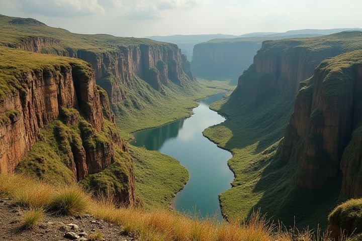
Niger River Basin
The Niger River Basin is a crucial geographical feature in Nigeria, characterized by its diverse landforms and ecosystems. This basin spans approximately 1,400 kilometers, providing vital resources and habitats, with its delta rich in wetlands and biodiversity. Surrounding the basin, you can find upland and lowland terrains, which support various agricultural practices crucial for the local economy. The intricate network of tributaries and floodplains within the Niger River Basin also plays a significant role in regulating climate and water supply across the region.
Jos Plateau
The Jos Plateau, located in central Nigeria, is a prominent landform characterized by its elevated terrain and rich geological features. This distinct plateau, primarily composed of volcanic rocks, rises to about 1,200 meters above sea level, offering a unique biodiversity that includes several endemic plant and animal species. The region's landscape is dotted with picturesque hills, valleys, and rocky outcrops, making it an ideal location for agriculture and tourism. With its cool climate and scenic views, the Jos Plateau stands out as a significant geographical feature that contributes to Nigeria's ecological diversity and cultural heritage.
Mambilla Plateau
The Mambilla Plateau, situated in southeastern Nigeria, is renowned for its distinctive landforms, characterized by rolling hills, expansive grasslands, and steep escarpments. This elevated region, with altitudes reaching over 1,500 meters, experiences a cooler climate than much of the country, fostering a rich biodiversity and unique ecosystems. The plateau also features numerous swift rivers and streams, such as the Donga River, which contribute to its fertile agricultural lands, supporting crops like tea and coffee. Your exploration of the Mambilla Plateau unveils a blend of stunning scenery and cultural heritage, making it a significant geographical landmark within Nigeria.
Obudu Mountain
Obudu Mountain, located in the Cross River State of Nigeria, is renowned for its stunning terrain, characterized by steep hills, lush valleys, and an elevation of approximately 1,575 meters above sea level. This highland region forms part of the Obudu Plateau, which is distinguished by its rich biodiversity, including unique flora and fauna that thrive in its cool climate. The area is also famous for the Obudu Cattle Ranch, a prominent tourist destination featuring breathtaking views, a cable car ride, and various recreational activities that attract nature enthusiasts. Visitors to Obudu Mountain can experience the beauty of Nigeria's natural landscapes while exploring the cultural heritage of the indigenous communities that inhabit the region.
Cameroon Highlands
The Cameroon Highlands, a prominent geological feature in Nigeria's landscape, showcase a diverse range of landforms characterized by volcanic activity. These highlands are home to several peaks, including Mount Cameroon, one of Africa's tallest volcanoes, which rises to about 4,040 meters. The region's unique topography includes steep slopes, plateaus, and valleys, providing rich habitats for various flora and fauna. As you explore the Cameroon Highlands, you'll encounter a variety of ecosystems, from lush tropical rainforests to alpine meadows, making it a vital area for biodiversity.
Sahel Region
The Sahel region of Nigeria is characterized by a diverse range of landforms that include arid plains, rolling hills, and scattered plateaus. This transitional zone between the Sahara Desert to the north and the more verdant savannah regions to the south features significant features such as the Adamawa Highlands, known for their rugged terrain and distinct biodiversity. The area experiences a hot climate with seasonal rainfall, impacting soil fertility and vegetation patterns, which predominantly consist of drought-resistant grasses and acacia trees. Understanding the landforms and their ecological significance is crucial for managing resources and planning sustainable agricultural practices in this unique environment.
Coastal Plains
Nigeria's coastal plains stretch along the Atlantic Ocean, primarily in the southern region of the country. This landform features low-lying areas characterized by rich alluvial soils ideal for agriculture, supporting crops like rice, cassava, and oil palm. The coastal plains are dotted with lagoons and mangrove swamps, which provide critical habitats for various biodiversity, including fish and bird species. These plains also play a vital role in Nigeria's economy, as they are home to major port cities such as Lagos and Port Harcourt, facilitating both trade and maritime activities.
Nigerian Savannah
Nigeria's landscape is characterized by diverse landforms, with the savannah dominating the central and northern regions. This biome features a mix of grasslands and scattered trees, supporting a rich biodiversity of plants and wildlife, such as elephants, lions, and various bird species. The Nigerian savannah experiences a distinct wet and dry season, which influences agricultural practices, particularly the cultivation of crops like millet and maize. You can encounter cultural groups in this area, who engage in traditional farming and pastoral activities, creating a unique blend of human and ecological interactions.
Cross River Basin
The Cross River Basin, located in southeastern Nigeria, features diverse landforms characterized by its mountainous terrain and fertile river valleys. This region is defined by the imposing Obudu Plateau, which boasts scenic views and rich biodiversity, making it a prime area for agriculture and tourism. The Cross River itself meanders through lush forests, supporting various ecosystems and providing vital resources for local communities. Your exploration of this basin will reveal the intricate relationship between its topography and the cultural practices of the indigenous populations residing along its banks.
Chad Basin
The Chad Basin, located in northeastern Nigeria, is a prominent geological feature characterized by its flat and arid landscape, primarily composed of sedimentary rocks. This low-lying area is part of a larger semi-arid region that experiences significant seasonal fluctuations in water levels, particularly in Lake Chad, which has dramatically shrunk in recent decades. The basin supports unique ecosystems and diverse wildlife, with vegetation primarily consisting of grasses, shrubs, and a few scattered trees adapted to the harsh conditions. Agriculture and fishing in the Chad Basin provide critical livelihoods for local communities, shaped by the basin's dynamic environmental conditions and the challenges posed by climate change.